HELP Alerts is an innovative system for establishing direct two-way communications with customers during roadway closures or other emergencies. With a simple dashboard, agencies can instantly activate a dynamic website, a text messaging system, and a phone system for communicating directly with travelers.
HELP Alerts is built on Information Logistics' award-winning incident response and information system to establish direct two-way communications with travelers during roadway closures or other emergencies. HELP Alerts integrates with FEMA's Wireless Emergency Alerts, and is recognized as a demonstrated alert origination software. HELP Alerts can also be used for your non transportation-based communication needs. Additional templates are available to facilitate inter and intra agency communication.
HELP Alerts™
- Enable TMC Operators to have one or two-way communications with travelers in the geofenced area.
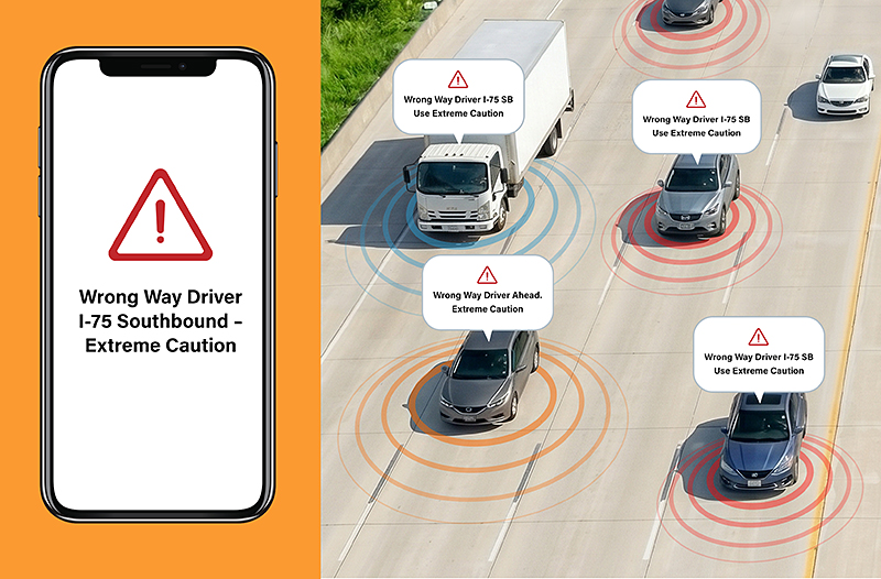
- Rapidly send real-time alerts to vehicles approaching a Wrong-Way Driver.
- Reaches mobile phones with no app download needed.
- Ongoing updates to drivers who opt in.
- Send Fleetworthy Emergency Alerts directly to commercial vehicles' in-cab equipment.
When HELP Alerts™ are Used
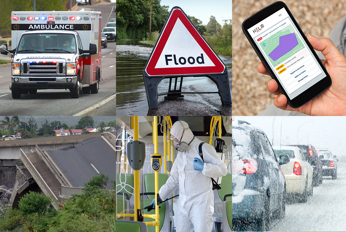
HELP Alerts can be used in many types of emergency situations to:
- Effectively communicate with drivers stopped due to multi-vehicle pile-ups, HAZMAT situations, unexpected bridge closures, fatal accident situations, etc.
- Notify traffic approaching major highway incidents and closures.
- Warn about wildfire smoke obstructing roadway visibility.
- Alert travelers about extreme weather and flooded roadways.
- Distribute evacuation alerts for natural disasters.
How HELP Alerts Work
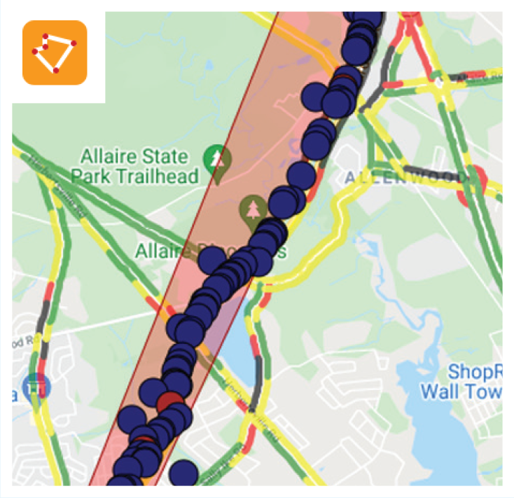
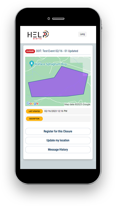
The agency staff draws the geotarget area of concern on the map.
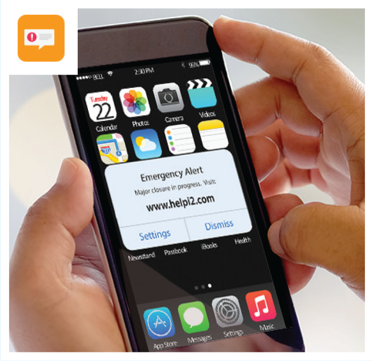
HELP Alerts sends a WEA to travelers in the targeted area to get their attention. The travelers can opt in to communications during the event
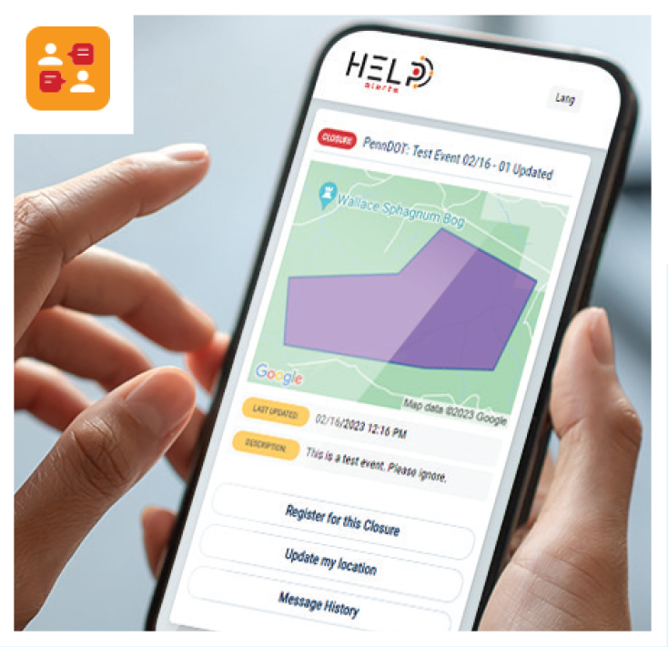
The agency staff can communicate directly with the travelers who have opted in during the event.
Rapid HELP Alerting
Rapid HELP Alerting brings near instant, multi-channel notification to one of the most dangerous roadway events: Wrong-Way Driving (WWD). By pre-defining geofences and approved alert text for high-risk locations, operators can issue a Wrong-Way Driver alert in seconds. The system can simultaneously warn right-way drivers, commercial vehicles, and potentially prompt the wrong-way driver to take corrective action. The alerts can be distributed to mobile phones, commercial vehicles in-cab units, and in-app navigation platforms such as Waze and Apple Maps. This creates a fast, coordinated safety response that supplements existing WWD programs.
Product Sheet